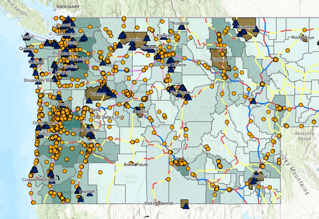
This GIS-based mapping and planning tool from the Tribal Green Transportation Project highlights existing EV charging stations, Tribal lands and interest points, and alternative fuel corridors in Washington, Oregon, Idaho, and Montana.
Using publicly available data and information, the tool empowers Tribes to incorporate transportation electrification into Tribal planning and investments.
More about the tool
The development of the tool was supported by federal and state initiatives. WSU Energy Program’s Green Transportation Program interns Bryan Strom Jr. and Michael Stewart developed the tool.
For feedback, additional support, or help creating an individualized map for your Tribe, please contact Bryan Strom Jr. or Brad James.